


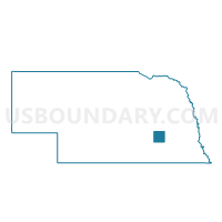
Hays Precinct, York County, Nebraska
About
Outline

Summary
| Unique Area Identifier | 614043 |
| Name | Hays Precinct |
| County | York County |
| State | Nebraska |
| Area (square miles) | 35.87 |
| Land Area (square miles) | 35.72 |
| Water Area (square miles) | 0.16 |
| % of Land Area | 99.56 |
| % of Water Area | 0.44 |
| Latitude of the Internal Point | 40.73831380 |
| Longtitude of the Internal Point | -97.66420090 |
Maps

Graphs
Select a template below for downloading or customizing gragh for Hays Precinct, York County, Nebraska


Neighbors
Neighoring Voting District (by Name) Neighboring Voting District on the Map
- #103 Precinct, Fillmore County, NE
- Brown-Henderson Precinct, York County, NE
- Leroy-Baker Precinct, York County, NE
- McFadden Precinct, York County, NE
Top 10 Neighboring County Subdivision (by Population) Neighboring County Subdivision on the Map
- Henderson precinct, York County, NE (1,215)
- Baker precinct, York County, NE (653)
- McFadden precinct, York County, NE (498)
- Hays precinct, York County, NE (334)
- Grafton township, Fillmore County, NE (245)
- Brown precinct, York County, NE (204)
- West Blue township, Fillmore County, NE (85)
Top 10 Neighboring Place (by Population) Neighboring Place on the Map
Top 10 Neighboring Unified School District (by Population) Neighboring Unified School District on the Map
- York Public Schools, NE (9,028)
- Fillmore Central Public Schools, NE (3,518)
- Heartland Community Schools, NE (2,063)
- McCool Junction Public Schools, NE (866)